May 20, 2026
Notice regarding visits to Motonosumi Shrine 2026
- >
- Nanavi News
- >
- Distribution of “Nagato Trail” course maps has begun.
Distribution of “Nagato Trail” course maps has begun.
-
Last updated:
Apr 9, 2025
-
About the writer:
Nagato Tourism Convention Association
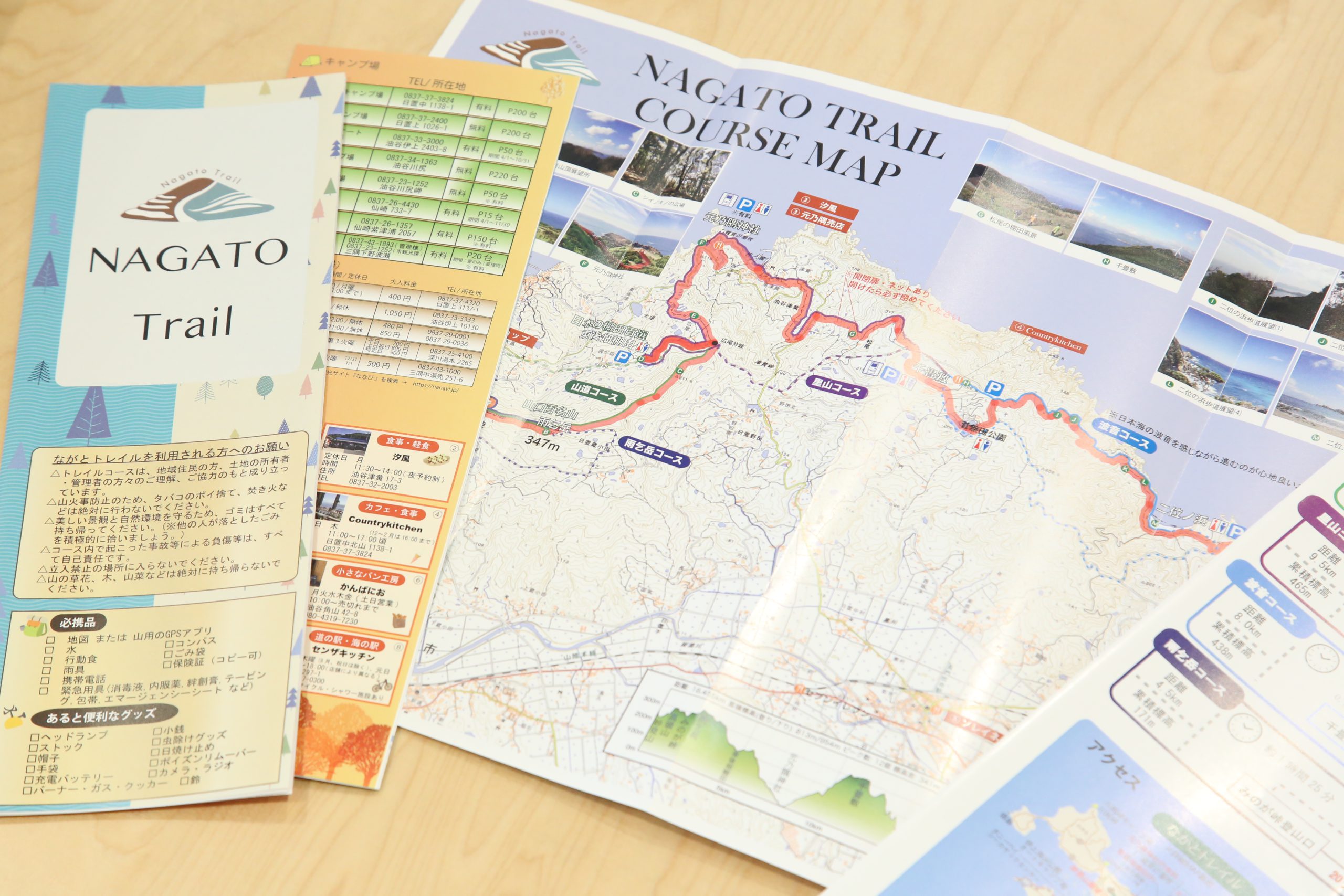
18.5 km connecting Myokenzan Observation Park to Kohado Onsen
In March 2020, the Nagato Trail, a trail running/walking course connecting Myokenzan Observation Park in Aburaya, Nagato City to the Kohado Onsen Exchange Center in Hioki, opened.


This project was planned by Ryosuke Ichinoe, a member of the Nagato City Regional Development Cooperation Team, and has been carried out in cooperation with local residents. Along the way, the course includes stops at such landmarks as Amegadake, one of Yamaguchi's 100 most famous mountains; Higashi Gohata Terraced Rice Fields, one of the 100 best terraced rice fields in Japan; Motonosumi Shrine;Senjashiki; and Niinohama Beach.


The newly created course map includes four courses: Mountain Path, Satoyama, Namine, and Amegadake. In addition to essential supplies and "useful goods," the map includes information on viewpoints, nearby stores, hot springs, campgrounds, and more to help those who enjoy activities such as running and walking.


Please enjoy the "Nagato Trail" with a map in hand, where you can enjoy the charms of both the mountains and the sea.
Course Map Locations
- Roadside Station Senza Kitchen Tourist Information Center YUKUTE
- Utsuga Branch Office, Aburaya Branch Office, Nagato City Hall